Buying a Lake Hartwell lot in Anderson County with dreams of stepping onto your own dock? You are not alone. The permit process can feel confusing, and listings do not always tell the full story. This guide gives you a clear, practical path to confirm whether a lot is truly dockable, who you need to contact, what the timeline looks like, and the documents to gather before you write an offer. Let’s dive in.
What “dockable” means on Lake Hartwell
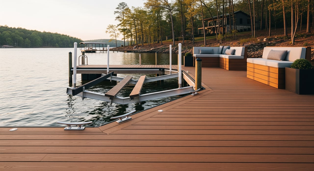
On Lake Hartwell, “dockable” means you can place a private dock with reasonable access to navigable water and obtain required approvals from the U.S. Army Corps of Engineers and state or local agencies. It is not just about having shoreline frontage. Water depth, shoreline slope, easements, nearby channels, and habitat all matter.
A lot can have attractive frontage and still not qualify for a private dock. Dockable does not mean guaranteed until the right authorities confirm it. Before you fall in love with a lot, plan to verify site conditions and permitability.
Who issues permits and what they review
Lake Hartwell is a federal reservoir managed by the U.S. Army Corps of Engineers through the Savannah District. Any structure that encroaches on reservoir beds, the water surface, or federally controlled shoreline typically requires USACE authorization.
State and local agencies in South Carolina also play roles. In Anderson County, expect potential involvement from:
- South Carolina Department of Health and Environmental Control: state water quality certification and related reviews when federal permits apply.
- South Carolina Department of Natural Resources: boating and fisheries considerations, including aquatic vegetation or species protections.
- Anderson County planning and building staff: setbacks, septic considerations, and whether zoning or local rules affect your shoreline use.
- Homeowner associations or recorded covenants: some communities limit or prohibit private docks.
In general, USACE evaluates encroachments on federal lands and waters, navigation and safety, and resource reviews. State and county staff focus on water quality, setbacks, and local compliance. HOAs can add private restrictions.
How to verify if a lot is dockable
You can confirm dock potential with a few targeted steps and the right documents. Start early and document every conversation.
- Request from the seller: deed, plat, survey, HOA covenants, any prior USACE permits, and dock construction records.
- Order a certified boundary or topographic survey marking the Ordinary High Water Mark and any easements.
- Ask the listing agent to obtain copies of any prior USACE authorizations or project files tied to the parcel.
- Contact USACE Lake Hartwell staff to ask about parcel-specific constraints like cultural resources, prior notices, or dredging restrictions.
- Have a licensed dock builder check water depth, access, and the likely footprint for a fixed pier or floating dock.
- Review SCDHEC and SCDNR resources for wetlands, submerged aquatic vegetation, or sensitive habitats nearby.
Red flags in listings and plats
Watch for signals that suggest a lot may not be dockable:
- Listing language that notes “no dock allowed” or “no riparian rights.”
- Deed or plat language that reserves the shoreline to an HOA or a conservation easement.
- Very shallow or heavily vegetated shoreline in photos or disclosures.
- Narrow frontage with a public or utility easement crossing the riparian area.
If you see any of these items, plan extra diligence and a direct confirmation with USACE before moving forward.
Permit types and common conditions
Most routine residential docks are authorized by general permits or letters of permission with standard conditions. Larger or more complex projects may require an individual permit and a more detailed review.
Typical permit conditions can include:
- Maximum dock size, length, and number of slips.
- Construction material standards and whether floating or fixed elements are allowed.
- Setbacks from property lines and separation from adjacent docks.
- Limits near navigation channels or public facilities.
- Seasonal work windows to protect fish spawning or vegetation.
- Requirements to avoid or mitigate impacts to wetlands or aquatic vegetation.
- Corrections to existing unpermitted structures as a condition of new authorization.
Timeline basics for Anderson County buyers
A straightforward residential dock can move efficiently when you prepare a complete package. Plan for the following phases:
- Pre-application inquiry with USACE and any state points of contact: days to weeks.
- Application preparation with surveys, plans, photos, and contractor input: about 2 to 6 weeks.
- Agency review window:
- General permits or letters of permission: often 30 to 90 days depending on workload and whether state review is needed.
- Individual permits for complex cases: 3 to 12 months or more due to public notice, comment, and resource reviews.
- Post-authorization steps: performance conditions, pre-construction notifications, and final inspections.
- Construction scheduling: depends on contractor availability and any seasonal restrictions.
Factors that extend timelines include wetlands or listed species habitat, cultural resource reviews, neighbor objections, overlapping state water quality review, and incomplete submissions that require resubmittals.
Cost categories to plan for
Exact amounts will vary, but most buyers should plan for:
- Survey and professional site plans.
- Structural drawings or engineering for larger docks.
- Application fees and any required mitigation costs.
- Contractor construction costs and any necessary dredging or access work.
- Legal or consultant fees if riparian rights or easements are unclear.
Buyer documents checklist
Ask the seller and listing agent for:
- Current deed and chain of title showing riparian rights or shoreline reservations.
- Recent certified boundary or topographic survey with property lines to water, the Ordinary High Water Mark, elevations, and all easements.
- Copies of any federal or state permits for docks or shoreline work, including USACE permit numbers and decisions.
- HOA covenants and bylaws that reference docks, slips, or common waterfront rules.
- Any prior environmental reports or shoreline assessments.
- Recorded plat or subdivision record that indicates lot classification related to dockability.
- Photos of current shoreline conditions and nearby docks, plus typical water depths.
- Title commitment or survey exceptions that note rights-of-way and shoreline restrictions.
What your agent should obtain or order:
- A new boundary or topographic survey tied to the Ordinary High Water Mark that shows a proposed dock footprint.
- Bathymetric or depth soundings at the proposed dock location.
- A written guidance note or contact record from USACE Lake Hartwell staff regarding the parcel’s permitability.
- Written HOA approval or recorded rules for slip assignments if relevant.
Simple shoreline diagram
Use this simple map to visualize key features that affect a dock plan.
  Inland
---------------------- P (property line)
                 |    OHWM (shoreline)
----------------------  <— vegetated/littoral zone
      Lot yard
      [house]        N    D
                   \  |----|  <-- proposed dock footprint
                    \_|____|____  <- lake surface (L)
                       C  (channel)
                     E (utility easement parallel to shore)
How to read it:
- Verify where the OHWM and property line fall relative to any recorded easements.
- Note proximity to the navigation channel and neighbor docks.
- A proposed dock must avoid easements, protect navigation, and meet permitted footprint limits.
Action plan for Anderson County buyers
Follow a simple, step-by-step process before you go under contract on a waterfront lot.
- Request the deed, plat, HOA documents, and any prior permits from the seller.
- Order a current survey showing the Ordinary High Water Mark and all easements.
- Have a local dock contractor take depth soundings and sketch a conceptual dock plan.
- Contact USACE Savannah District staff with parcel details and request written guidance on dock eligibility.
- If there are constraints, ask about design alternatives like a smaller footprint or a floating configuration.
- Build permit time and potential costs into your offer terms and closing timeline.
- If needed, add a permit-based contingency with a realistic window.
Final thoughts
Buying on Lake Hartwell can be a great decision, but the value of a waterfront lot often ties directly to dock potential. A little diligence up front can save time and money, and it positions you to secure the right lot with confidence. Start early, document everything, and keep your application package complete and clean.
If you are weighing lots in Anderson County and want a clear path from offer to launch day, reach out to Joseph Cann. You will get local guidance grounded in practical land expertise and an easy-to-follow plan for your next steps.
Ready to talk through a specific lot or set up a search for dockable properties? Contact Joseph Cann today.
FAQs
What does “dockable” mean on Lake Hartwell in Anderson County?
- It means you can reasonably access navigable water and obtain required approvals from the U.S. Army Corps of Engineers and relevant state and local authorities.
Who do I contact first about a Lake Hartwell dock permit?
- Start with the U.S. Army Corps of Engineers Savannah District for Lake Hartwell, then coordinate with SCDHEC, SCDNR, and Anderson County planning as needed.
How long does a Lake Hartwell dock permit usually take?
- Simple residential docks often take 30 to 90 days after a complete submission, while complex or individual permits can take 3 to 12 months or more.
What can cause permit delays for a Hartwell dock?
- Wetlands or aquatic vegetation, cultural resource reviews, neighbor objections, overlapping state water quality review, and incomplete applications.
Do HOA rules affect whether I can build a dock?
- Yes. HOA covenants can limit or prohibit private docks, so always review recorded rules and obtain written approval when required.
Are existing unpermitted docks a problem when buying?
- They can be. USACE may require removal or modification of unpermitted structures as a condition of any new authorization.
What documents should I gather before making an offer on a waterfront lot?
- Deed and survey with OHWM, prior permits, HOA covenants, shoreline photos, depth soundings, and any written guidance from USACE regarding permitability.